RIVELS
If this is real, you know they have better sex than any of us.
It’s lucky he’s the vector data guy because if she was in charge of aiming it in there’d be rounding errors
It’s fun trying to figure out what their dirty talk is like.
That is a good way to get citations, NGL.
I aspire to be that professor that’s married to their arch-academic-enemy
What a weird idea that there is any sort of rivalry between two data types used in the same science. I have a hard time believing that any geospatial science professor is in a war over this. Analogously this would be like two carpenters having a war over saws vs hammers. They are both indispensable tools in carpentry. Sometimes you saw something and then use a hammer on the next step, sometimes you hammer something and saw something next. It’s… You use both. You’ll always use both.
But someone making about as many spelling mistakes as there are words in the post should be the first red flag. This reads like someone who slept through an intro to GIS course, or someone who hates ESRI (based?) and wanted to simultaneously send their entire board of directors into seizures.
Anyway, QGIS gang 😎
WHERE IS PART 3 I NEED TO KNOW THE FALLOUT
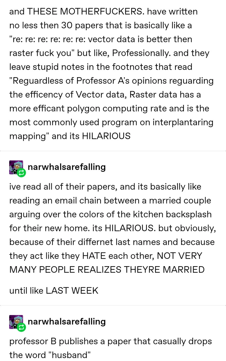
I went hunting and found OOP’s blog. There isn’t much more to the story, which I will transcribe here:
until like LAST WEEK
professor B publishes a paper that casually drops the word “husband”
and obviously all the students are like “oh i didn’t know u were married!” because we read that shit like how white suburban mothers read People Magazine
and shes like “yeah, it’s Professor A”
and we all FLIPPED. THE FUCK. OUT
we thought the framed picture of the two of them on professor A’s desk was ironic because hes that type of guy
like, you gotta understand, these two have gotten into YELLING matches in hallways. these two refuse to go on trips with each other. but apparently they have a system where they quite LITERALLY leave all of their work at work and drive home in separate cars and literally NEVER work at home. it is SO funny
okay SO, yeah, well, anyway, okay like, there’s this HILARIOUS RIVELRY going on between those two teachers I no and it’s all written DOWN in scientifatic PAPERS that are publicly available for anyone but I won’t LINK them because shirley my badly spelt TALE of what happened sprinkled with RANDOM capitalized WORDS is much more HILARIOUS than anybody readings it FOR themselves
It sounds sweet.
The red zone is for immediate loading and unloading of passengers only, there is no parking in the white zone
Tease.
I really hope you’re obfuscating the real thing they are fighting over because it makes zero sense that anyone would fight over which is “better”. Like, what? You… You have to use both like… All the time. I’ve never had a project outside of a class assignment that didn’t require both.
WTF
My domain is more bioinformatics than GIS, but the way I imagined it was that if one was arguing that [thing] data is better, they’re arguing that if more people recognised the innate benefits of [thing], we wouldn’t have to rely on software that uses [other thing] so much, and that to properly utilise [thing], it would take a bit of radical reworking of workflows, but there would be significant long term net benefit.
Basically, I think arguments like this tend to be more grounded in the socio-cultural practices of a research field than the absolute technical merits of an approach. Like in my domain, a DNA sequence is just a long sequence of 4 different letters (A, T, G & C), but there’s a bunch of ways we can encode that data into a file, many of which have trade-offs (and some of which are just an artifact of how things used to be done)
the spelling is atrocious in this ffs
They really are a geographer
I can oddly relate because I’m taking courses right now that deal with these data sets, GIS is a great field with lots of opprotunities that pays well even in entry positions. If anyone is curious, they should look it up. It can be used in soooo many different applications and fields, it’s very versatile.
My dad is a software developer for a popular GIS software. It’s just weird to see someone on Lemmy talking about GIS lol
ESRI or Q? There are not that many. 😂 There are several GIS adjacent communities on here. We get obsessive.
Digpro actually. It may not be popular in the US but it’s big in Europe/Scandinavia.
map nerds unite ✊
DOIs or GTFO
Ah, dialectics.
Gotta be careful with those before a long trip.


